Introduction
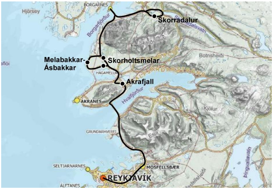
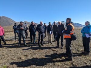
The 2022 NORDQUA excursion took place directly after the Nordic Geological Winter Meeting in Iceland, on May 14, 2022. The focus of the excursion was the Late Glacial glaciotectonics and marine limit shorelines of the Lower Borgarfjörður region, north of Reykjavik. Guiding us were Ívar Örn Benediktsson (University of Iceland) and Þorbjörg Sigfúsdóttir (Iceland Met Office) – the latter for which this area was the subject of her doctoral thesis. In total around 26 people were able to join for the day.
The Lower Borgarfjörður region in West Iceland has been key for understanding the deglaciation of Iceland and the collapse of the Iceland Ice Sheet in Bølling times, as well as for deciphering Younger Dryas and Early Holocene (Preboreal) glacier dynamics. The excursion visited marine limit shorelines and deltas in Akrafjall and Skorradalur, the spectacular Skorholtsmelar end-moraine complex, and the glaciotectonics of the Melabakkar-Ásbakkar coastal cliffs.
Akrafjall
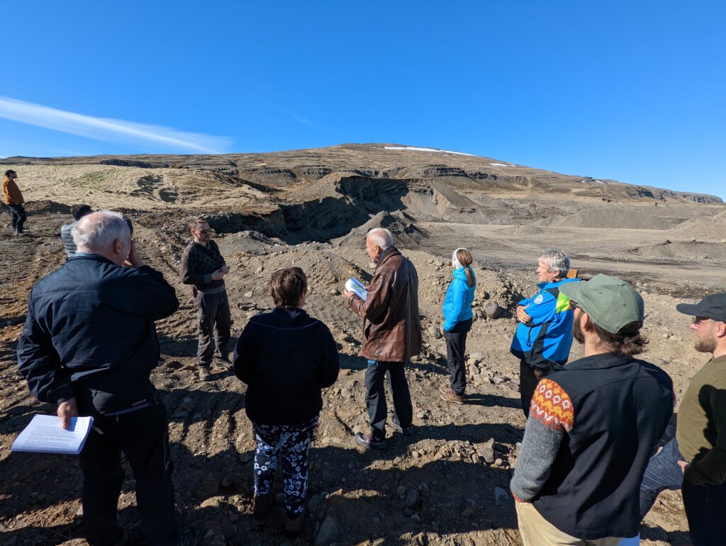
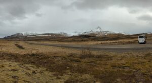
The mountain of Akrafjall lies on the Akranes Peninsula, around a 50-minute drive from the University of Iceland in Reykjavik. Here we went into the gravel pit where some significant whale bones were found within raised shorelines and dated to 14.700 years. The question is why are they here?
We know that the ice sheet was mapped to be 200 km offshore from here around 15.300 years ago where the sedimentological record shows marine sediments and till sediment below. The shelf-based part of the Iceland ice sheet collapsed rapidly within ~600 years due to rising sea level and was followed by rapid isostatic uplift of the Icelandic crust.
Skorholtsmelar end moraine complex
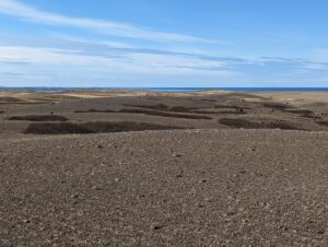
The Skorholtsmelar end moraine complex is a ~6-km long arcuate landform that rises ~20–40 m over its flat surroundings and has been interpreted as marking the maximum position of a Late Weichselian ice advance from Borgarfjorður.
Here we went up on a large ridge and observed that there were only large boulder spread on one half of the ridge top. Furthermore, there was a hummocky area on the west side. This gave rise to the interpretation that the ice advanced from the northwest towards the southeast, and like a carpet pushed up the large ridge and the two smaller ridges parallel to the big one we were standing on. The ‘pushed carpet’ interpretation was discussed and Ivar highlighted that similar morphologies are seen at modern glacier sites in Iceland such as Vatnajökull.
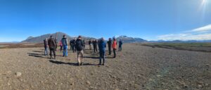
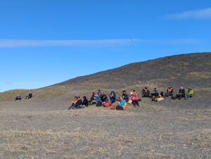
Súlunes (and lunch)
The sand dunes in this area are undated but are probably around 8000 years old. The sea level was at that time more than 40 m lower than today, while uplift is thought to have been completed. Given these timescales, uplift at Ás was probably around 20 m per 1000 years.
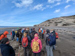
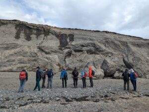
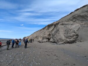
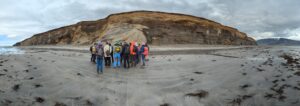
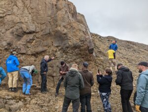
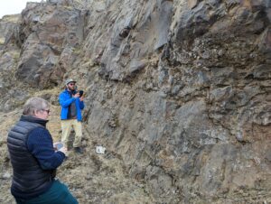
Melabakkar-Ásbakkar
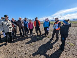
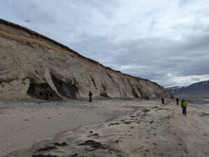
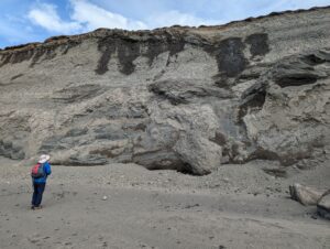
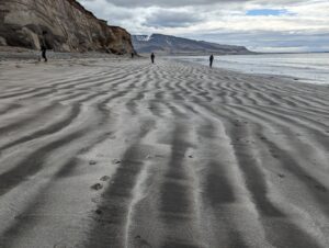
After lunch, we made our way along the coastline from Ás to Ásgil, following the line of the Melabakkar and Ásbakkar coastal cliffs. These cliffs are a fantastic record of the glaciotectonic end moraines in this part of Iceland. We observed evidence of glaciotectonics in this 6 km stretch of coastline with clear structural zones interspersed by undeformed, glaciomarine sediments.
Throughout this section we noted several morphological expressions of moraines within the lithified sediment, each stated to be related to a known end-moraine as part of the local end-moraine complex. The oldest of these moraines is dated to 14.9 ka at Ásgil North, while Ás demonstrates the youngest moraine at 13 ka, each of these being ~2600 m and ~3800 m along the coastal route respectively.
The deformation experienced by the sediments making up end-moraines reaches roughly 1.5 km from the historic glacial front, and is being eroded by the ocean at a rate of 0.5 m per year. This means that the coast extended 5km further at the end of the Younger Dryas!
From the start of the coastline, we followed the moraine complex up the coast, noting Younger Dryas dated moraines, the top layer of the cliff being characteristic of an erosional surface. This erosional surface supersedes an overturned section, which corresponds to the large moraine visited earlier at the Skorholtmelar complex. With this location being the proximal end of the moraine. We also noted that the sediments here, while young, were clearly lithified – a characteristic of the volcanic material common in Iceland, which cements and lithifies in less than 100 years.
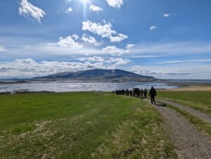
Skorradalur
After a bus journey, we find ourselves at Skorradalur, which is the site of the highest marine limit in Iceland, at 150 m a.s.l, and corresponding to the coastline at the gravel pit on the shoreline opposite Hafnarfjall. The marine limit is visible in the terrain from the stop location as a large terrace with a flat top, overlooking the surrounding landscape. Despite being 50 m higher in elevation to the opposing shoreline, they are both dated to the same age (14.7 ka), to which we note a great discrepancy in isostatic rebound between this and the opposing shoreline, of around 2.5 m per km!
What is uncertain about this upper marine limit is whether it is a beach, or an end moraine, along with many further questions which need to be answered, including the exact means in which it is connected to the shoreline across the fjord!
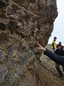
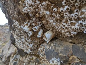
After another short coach journey, we made our final stop at a gravel pit, within the Skorradalur complex, at 70 m a.s.l.. There is evidence of marine influence in the sediments we found here, with barnacles present throughout the cliff face. This could be a result of a higher sea level, or major isostatic uplift. However, the sediments here also raise further questions, being dated to 11.7 kya.
Text: Lena Uldal Hensen and Thomas Barnes
Photos: Henry Patton