Through fortuitous circumstances, the NORDQUA Excursion this year ended up being held as part of a joint event with the 4th International PalaeoArc Conference, held in Akureyri – the capital of northern Iceland.
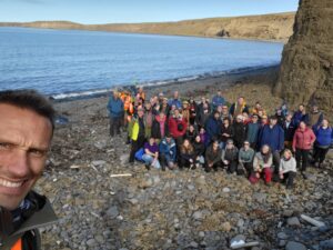
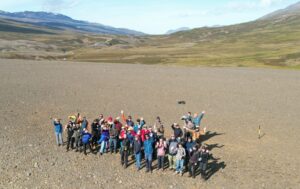
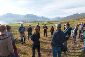
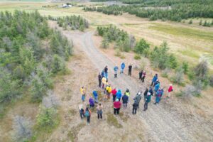
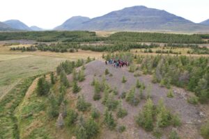
Members of both programs thus enjoyed the opportunity of a week of Quaternary science presentations, discussions, and multiple field excursions around northern Iceland. Around ~35-40 stayed for the NORDQUA day trips during the latter half of the week, which were attended by a wide mix of students, ECRs and professors.
The links below will navigate you straight to the relevant section of the report.
PalaeoArc Excursion (Tjörnes) | NORDQUA Day 1 (Fnjóskadalur) | NORDQUA Day 2 (Tröllaskagi) | NORDQUA Day 3 (Bárðardalur)
PalaeoArc Mid-Conference Excursion to Tjörnes
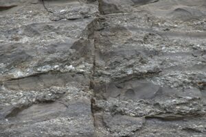
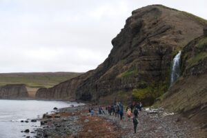
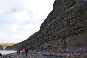
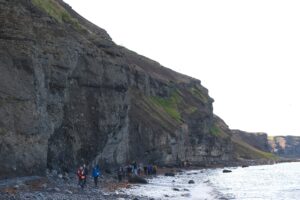
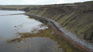
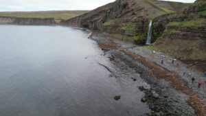
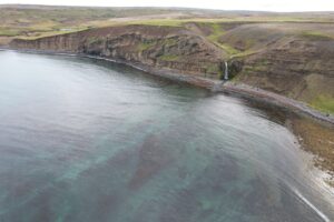
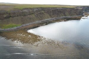
The Tjörnes sequence is one of the thickest (>1200m) sedimentary successions in Iceland and documents the transition from a relatively warm Pliocene climate through to the glaciations of the Pleistocene.
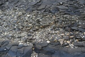
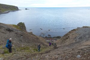
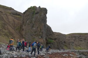
Led by Ólafur Ingólfsson, the day began at Tungulending examining part of the Tjörnes beds deposited during the Pliocene after 4.3 Ma. Abundant mollusc fossils found in the cliffs here – up to 100 different species – record a cooling shallow marine environment that started with water temperatures 5-10C warmer than today. Lava above these mollusc layers dates to ~2.6 Ma.
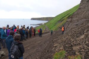
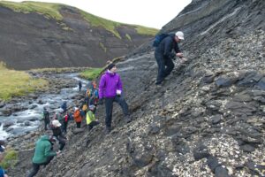
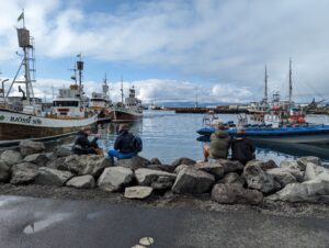
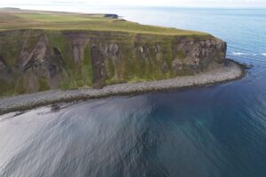
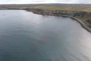
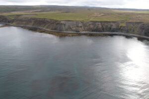
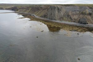
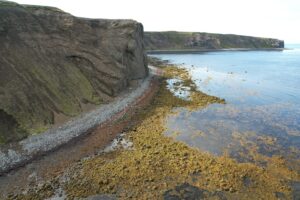
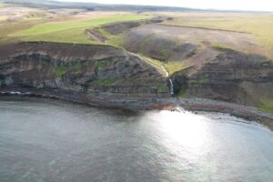
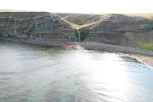
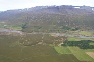
Following lunch at the harbourfront in Húsavík, Ólafur guided us into the Quaternary and along the Breiðavík deposits. Here 14 cycles of glacial and interglacial sediments, preserved by intervening layers of lava record a unique sequence of repeated glaciations to the northern coastline from 2.5-1.2 Ma. The day was wrapped up at the cliff viewpoint overlooking the tectonically controlled Öxarfjörður.
Drone shots from Breiðavík:
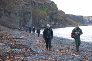
The NORDQUA Excursion
The NORDQUA 2023 excursion took place from 31st August to 2nd September and was run as three separate day trips from Akureyri to classic Quaternary geological sites in central north Iceland.
Day 1 (Fnjóskadalur) | Day 2 (Tröllaskagi) | Day 3 (Bárðardalur)
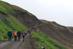
Day 1: Signatures of deglaciation dynamics, ice-lakes and their tephrochronological age control in Fnjóskadalur
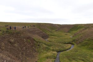
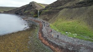
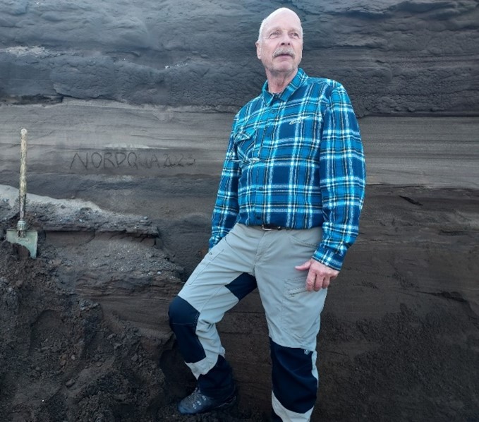
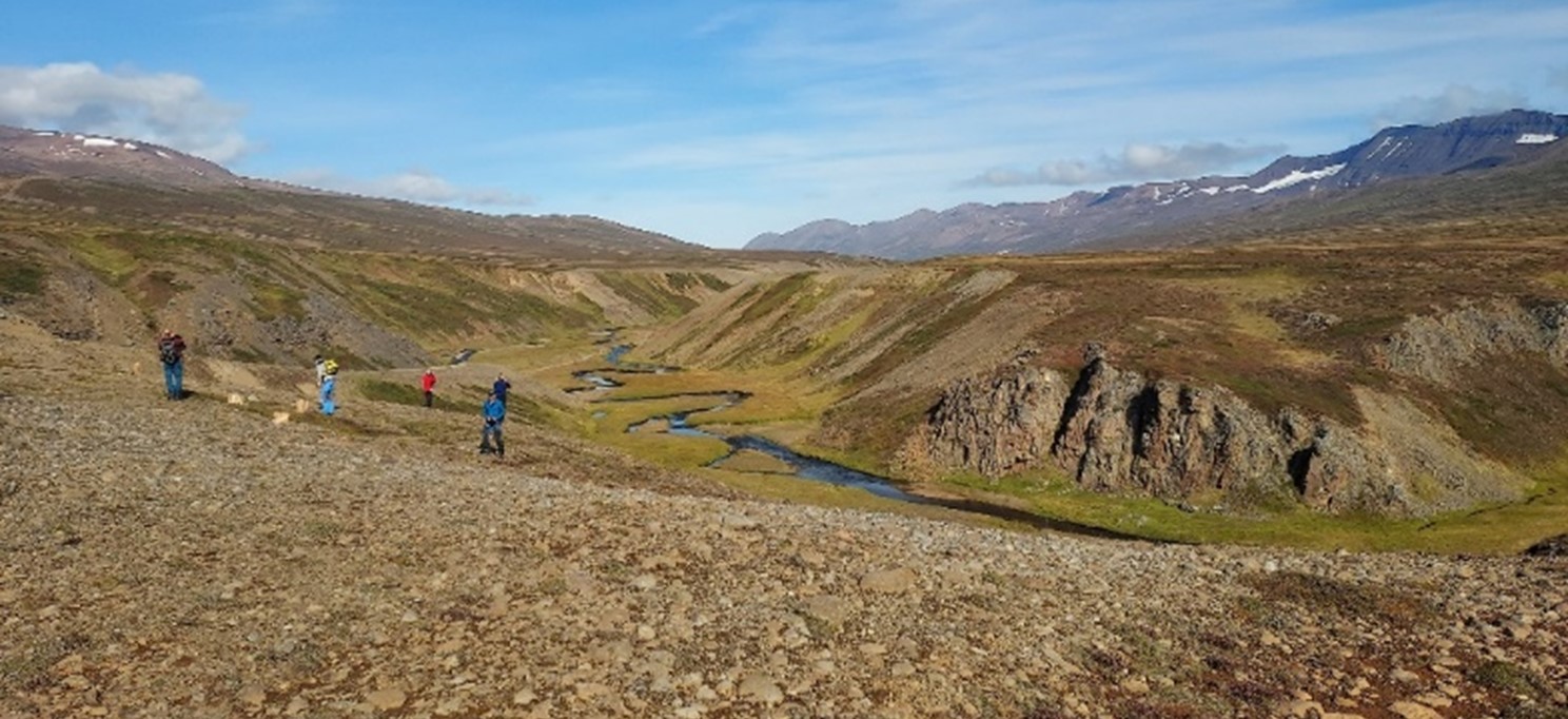
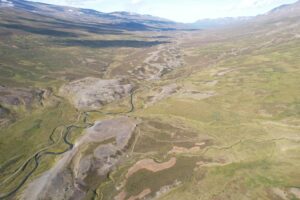
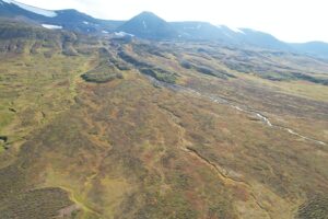
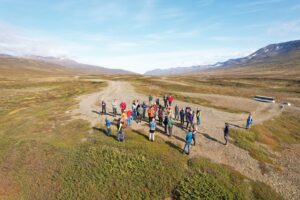
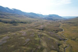
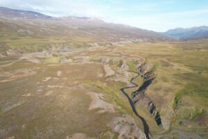
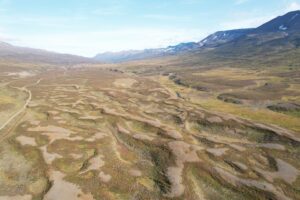
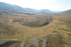
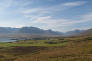
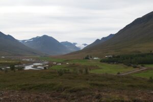
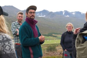
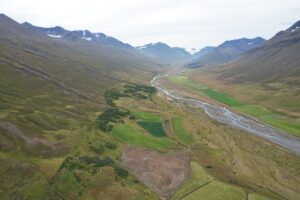
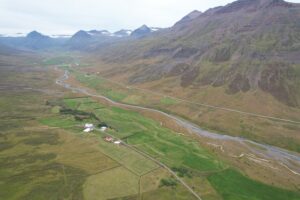
We spent the first day studying the remains of the palaeolake in the Fnjóskadalur valley, guided by Hreggviður Norðdahl who focussed on this area for this PhD thesis. Like the parallel Eyjafjörður valley lying to the west, Fnjóskadalur is a glacial U-shaped valley created along bedrock weaknesses. Local deglaciation started around 15 ka BP, but the main glacier that remained in Eyjafjörður dammed the outlets on the western side and created a series of proglacial lakes. Indeed, the alternated glaciolacustrine/glaciofluvial sediments indicate repeated episodes of draining, either to the north towards the shelf, or to the west into Eyjafjörður. The latter events implies that the main glacier in Eyjafjörður had thinned or retreated several times, because the western spillways sit at lower altitudes than the northern threshold.
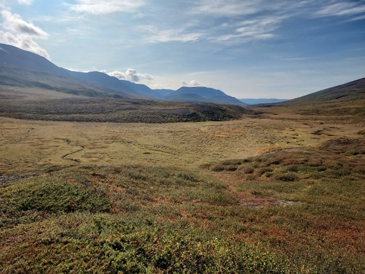
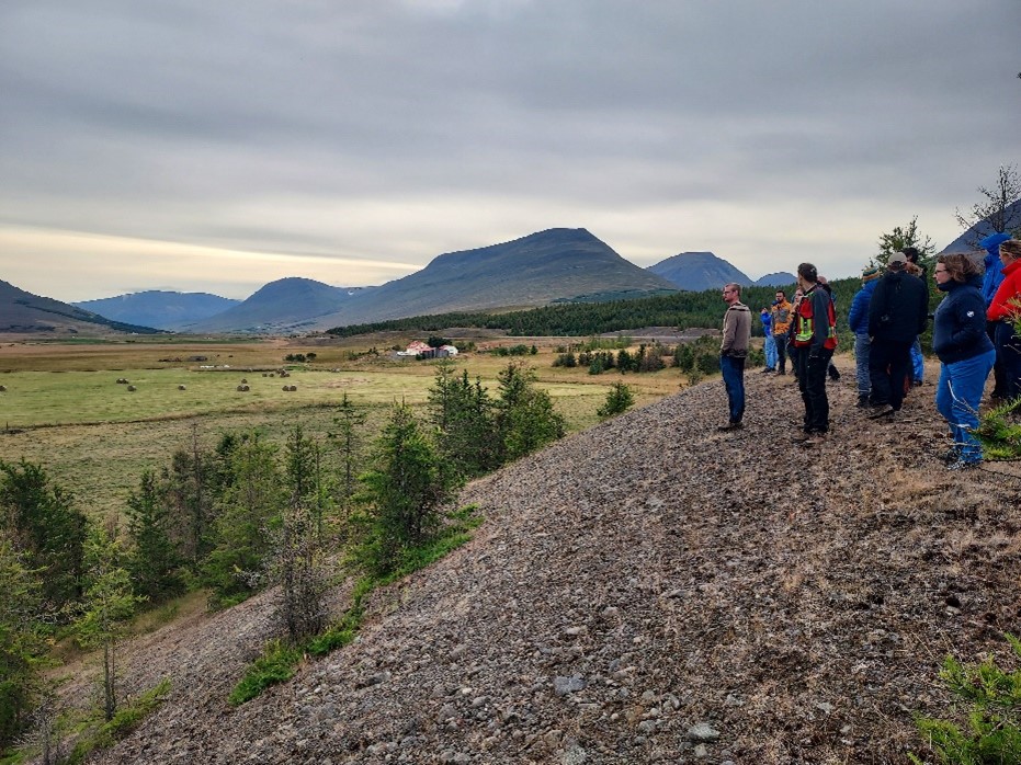
We drove all the way to the single northern spillway and its nice canyon, which was the outlet for all 8 high-level lakes. Along the way, we could distinguish most of the palaeo-shorelines, as well as many periglacial landforms, each one bringing a different piece of information about the succession of palaeolakes in the valley. Near the threshold we could observe how the outlet flow made its way to the sandur area by cutting through the ramified esker field marking the threshold point, and once deactivated, was partly overlaid by a colluvial slope fan which modified the profile of the palaeo-channel.
We also investigated a massive, well-preserved delta which has yielded much valuable information about the postglacial history of Fnjóskadalur. As a matter of fact, no radiocarbon dating of these landforms is available in the area because of the lack of organic remains, both in the terrestrial moraines and in Eyjafjörður marine sediments. The delta, however, contains the Skógar—Vedde tephra for which it is the type locality. This tephra is precisely dated to 12,050 BP and finely constrains the date of formation of this delta. Moreover, the third oldest proglacial lake was correlated with the onset of the Younger Dryas around 12 ka BP, which indicates a very dynamic postglacial landscape in the first three millennia after deglaciation.
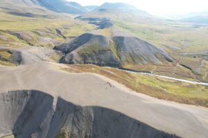
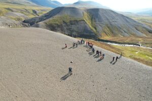
A little further south, the Skógar site that constituted our last stop features an impressive 160 m of ash accumulation! Enough for us to distribute some samples among ourselves for further reference… Being further inland, only a few palaeo-shorelines can be disentangled because the rate of isostatic uplift has noticeably differed between the coastal zone and the hinterlands.
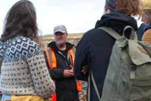
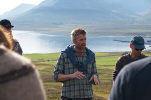
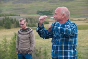
It was very enjoyable to listen to Hreggviður’s comments, and we were privileged to be the first to benefit from having him as our personal tour guide on this site he knows by heart!
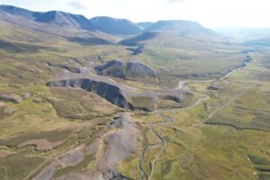
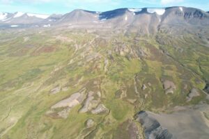
Drone shots from Fnjóskadalur:
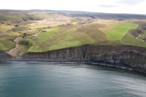
Day 2: The alpine glacial landscapes and slope instabilities of the Tröllaskagi Peninsula
The second day was dedicated to slope instabilities in the Tröllaskagi peninsula and the associated postglacial landforms. We first drove north to Dalvík and into the neighbouring valley of Svarfaðardalur; and in the afternoon we explored the upstream of the wide Eyjafjörður valley.
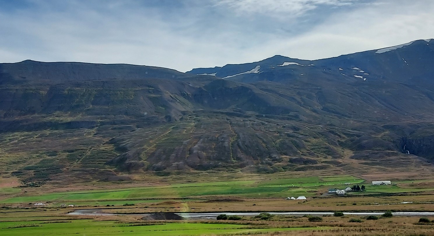
The ride to Dalvík made us pass by the island of Hrísey. It is a drumlin whose eastern half was eroded by the Lateglacial marine transgression. Another drumlin, south of Hrísey on the same shore, has a similar eroded flank, and viewed from the sea it shows till, fluvioglacial sediments and even a delta. The Eyjafjörður widens at the latitude of Hrísey: its main branch continues northwards, and a secondary branch has ploughed the more fragile bedrock of Svarfaðardalur. The local tectonic system was very dynamic and responsive to mass changes due to glacial cover variations. Iceland began its isostatic uplift at 10 ka BP at the shelf rim, and at 9 ka BP as a whole. The modern-day Vatnajökull, which is the largest remaining ice cap, still has a negative mass balance and the terrain around it is uplifted by 35 mm/y.
Likewise, the proglacial features observed in Dalvík such as the terminal moraine, ice-contact delta, kettle holes, and raised beaches are related to the history of glacial extent. The successive advances and retreats of the glacier locally triggered relative marine regressions and transgressions, respectively: the disappearance of the ice cover diminishes the mass weighing on the bedrock, causing a local uplift which makes the sea level decrease relative to the raised original shoreline.
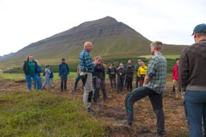
We stopped above Dalvík to observe several moraines left by corrie glaciers. Their location in the landscape, with lateral moraines aligned with the slope and terminal moraines perpendicular to the valley axis, can make them a prominent feature deflecting avalanches, which has influenced the localisation of human settlements and buildings. The presence of these glacial remnants shows that while the large valley glaciers disappeared during the deglaciation, a discontinuous ice cover persisted throughout the Holocene in the mountains of the Tröllaskagi peninsula.
Today there are around 150 glaciers left in Tröllaskagi, ranging from 0.2 to 6 km2 in area. Most of them are debris-covered, and were likely the only ones to have survived the Holocene thermal maximum. They have contrasting and variable mass balances: there is an overall mass waste trend but many had years of positive balance in the last few decades, some even exhibiting a surging behaviour.
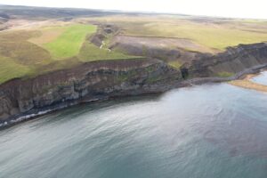
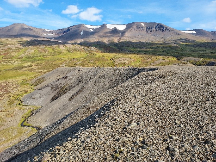
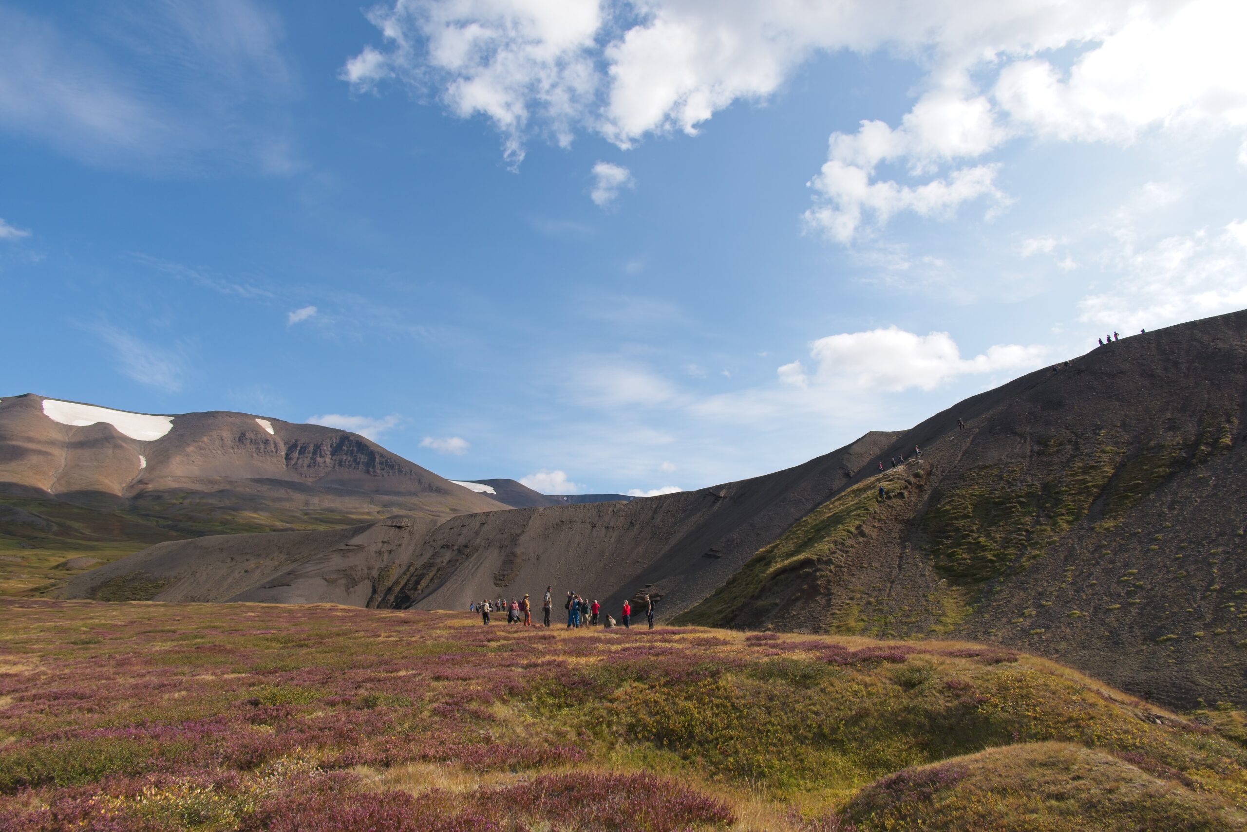
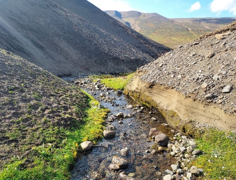
Venturing further up into Skiðadalur, we had lunch on top of the terminal end of a large rockslide deposit that once barred the valley. Many such landslides have been mapped in the last years in the Tröllaskagi peninsula, some of which still being active and creeping. The high density of these slope instability features can be explained by the local orogeny, because the volcanic bedrock has been largely affected by intense tectonic activity, and the erosion exploiting these weak lines was later aggravated by the Quaternary glaciation. For instance, the Husavík—Flatey fault starting 20 km further north is the most active one across Iceland and the Norwegian Sea; it has caused earthquakes with a magnitude up to 7.5, which is comparable to the famous San Andreas fault! There is evidence suggesting that this generalised intense seismic activity may have triggered major rock collapses in unstable slopes, or reactivated unsettled deposits. Large landslides across basaltic Iceland occurred 12 to 11 ka BP in higher altitudes, mobilising big volumes of material.
Some 20 km into the Eyjafjörður main valley, we stood on what was the glacier’s terminal moraine, constituted of reworked marine sediments. Successive instances of glacial advances and retreats have led to as many marine regressions and transgressions, triggered by the sensitivity of Iceland’s northern rim to isostatic processes. As evidenced by the mountains in the background, the Eyjafjörður valley glacier has carved several hundred metres deep into the plateau bedrock.
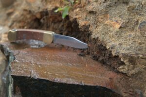
In the afternoon we turned around and travelled far up the main Eyjafjörður valley to visit some interesting deposits scattered along the way. Among them were a terminal moraine made of reworked coastal marine sediments, and another large landslide deposit. Upon returning to Akureyri, we stopped one last time at a newly excavated site where we could see many different tephra layers corresponding to various eruptive events. Many volcanoes such as Hekla erupt in two phases: the first white ash plume is acidic because the less dense rhyolitic magma sits on top of the magmatic chamber; then if the eruption continues it bursts out denser basaltic material that creates an overlying black tephra layer.
Drone shots from Eyjafjörður
Day 3: Geomorphological fingerprints of fast-flowing ice streams within the Iceland Ice Sheet in Bárðardalur
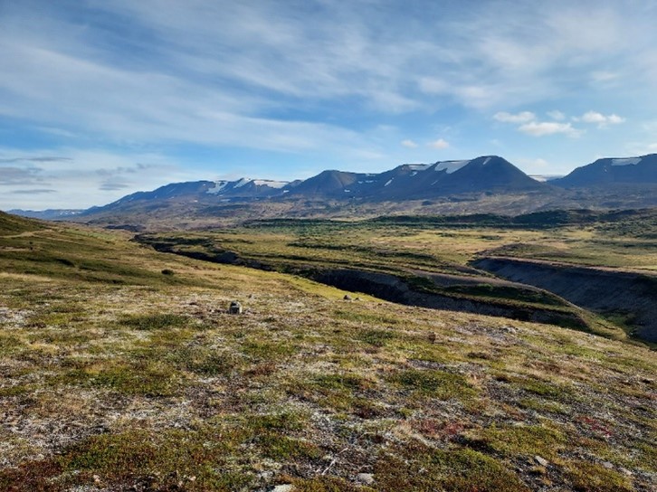
On our last day, we ventured east towards Mývatn and up on the first heights of the Icelandic plateaux, to have a look at the geomorphological fingerprints left by the Icelandic Ice Sheet. We took our first stop at the majestic Aldeyjarfoss waterfall. There, the river flowing from the highland plateau has cut through two overlying lavas and pours down on the third, oldest lava. These three lava flows named Barðardalshraun have a similar origin, from the eastern volcanic system of Iceland which neighbours the Vatnajökull. The most remarkable feature highlighted by the waterfall is the structure of the intermediate lava, which is constituted of very distinctive columnar basalts. These hexagonal pillars form when a large volume of lava can cool slowly and evenly, for instance when the flow is retained in a basin, and the volume loss subsequent to crystallisation creates this homogeneous pattern. The long axis of the pillars is always perpendicular to the plane formed by the cooling surface, and this is why these structures are often vertical because they are cooled at the interface with the air, which is the horizontal surface of the lava pool.
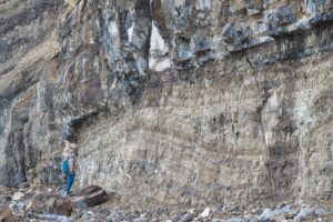
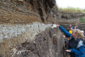
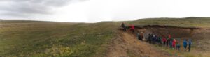
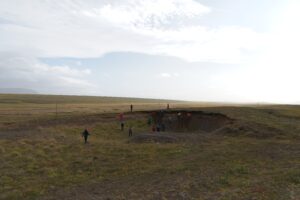
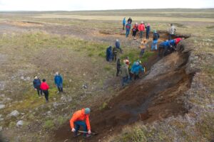
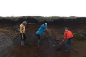
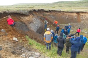
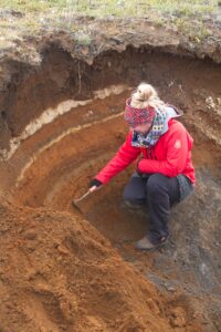
We then moved on to the plateau to examine subglacial landforms more closely, and especially from the inside. We stopped at Engidalur where a W—E section became exposed after an excavation. Although only a few metres deep, this cross-section provided a good general overview of the overall structure of these elongated landforms and the subglacial processes that generated them. Generally speaking, most of the mega-scale glacial lineations (MSGLs) found there have been built on the basis of preexisting landforms, because subglacial features get reworked and expanded with other subglacial material in fast-flowing ice caps such as the Icelandic Ice Sheet. It is this fast-flowing regime that creates such elongated landforms: drumlins and MSGLs are essentially the same landform because they are created by the same process, but the latter name is given for features whose elongation ratio is above 1:10. In the case of the Engidalur section, the reworked glaciolacustrine sediment in the intermediate layer (silt and sand) indicates the past presence of a proglacial lake in the area when the Icelandic Ice Sheet temporarily retreated into the hinterlands.
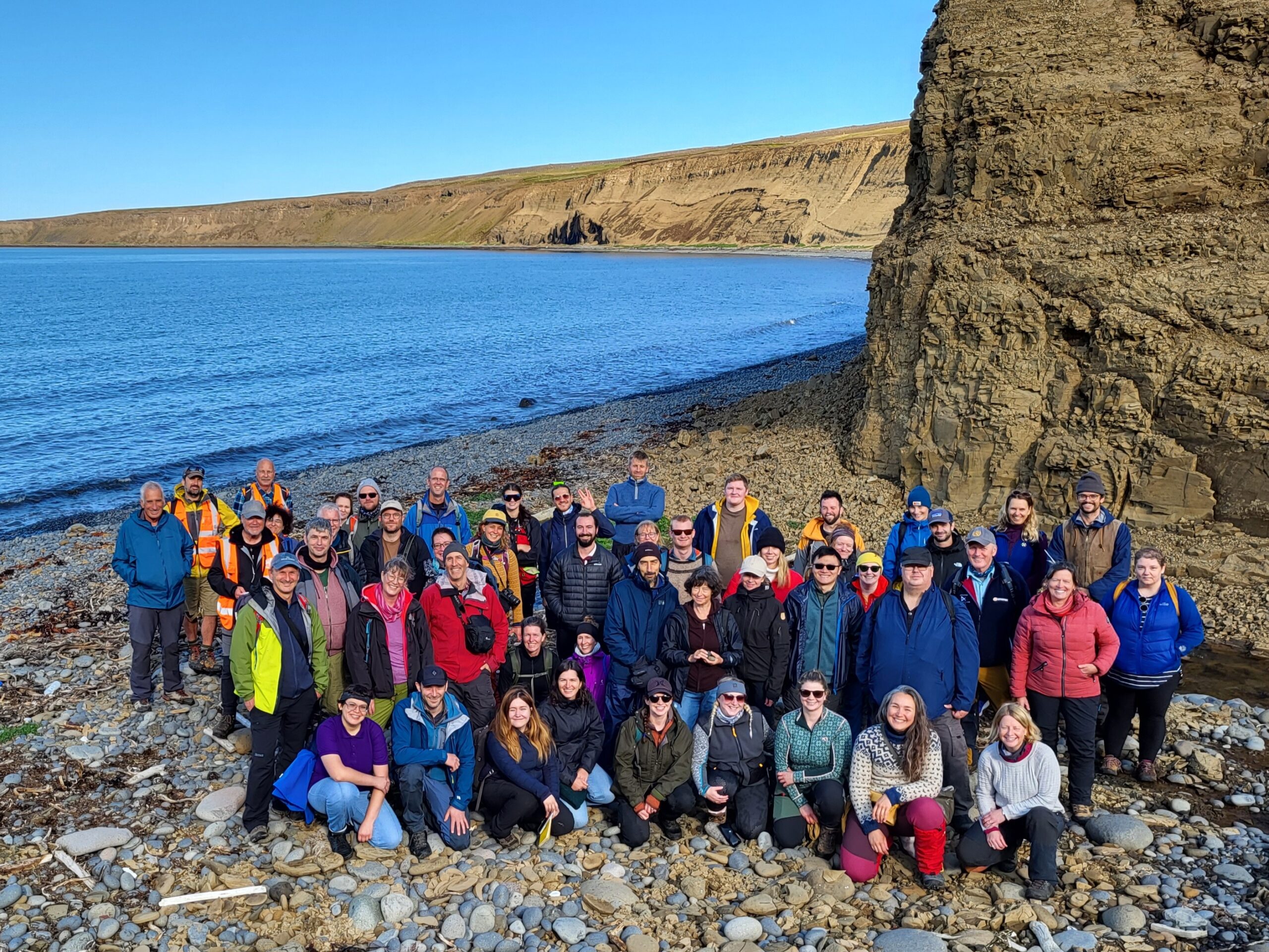
We give our many thanks to the Local Organizing Committee for hosting a most enjoyable week of Quaternary science, sights, and discussions.
- Ívar Örn Benediktsson, University of Iceland
- Wesley Farnsworth, Univerity of Iceland and University of Copenhagen
- Esther Ruth Guðmundsdóttir, University of Iceland
- Skafti Brynjólfsson, Icelandic Institute of Natural History
- Hreggviður Norðdahl, University of Iceland
Report text: Aloïs Revéret / Henry Patton
Photos: Henry Patton / Aloïs Revéret / Ívar Örn Benediktsson